
Dear Washington State Elected Leaders, Decision Makers, and Army Corps of Engineers, Portland Division:
Based on current observations of the recent Cowlitz River flood event, I am writing to express serious concerns regarding sediment accumulation in the Cowlitz River corridor between the mouth of the Cowlitz River and the mouth of the Toutle River.
This reach of the river appears to contain a significant amount of sediment buildup deposited since approximately 1995. These deposits may be contributing to increased flood risk, reduced channel capacity, and ongoing ecological and economic impacts.
In light of these conditions, I respectfully request that you pause the proposed $56 million Sediment Retention Structure (SRS) Spillway Raise project, currently scheduled for July 2026.
My concern is that the proposed spillway raise relies on 2019 data, which may no longer accurately reflect current river conditions, sediment loads, flood behavior, or environmental and economic considerations. Given the scale of public investment and the long-term implications of this project, it is both reasonable and prudent to conduct a comprehensive feasibility study to obtain updated and current data first.
Such a study should evaluate whether the proposed SRS Spillway Raise remains the most effective solution for:
- Protecting public health and safety,
- Reducing flood risk,
- Managing sediment transport, and
- Supporting long-term natural habitat recovery under present-day conditions.
Thank you for your consideration of this request and for your continued commitment to responsible flood management, environmental stewardship, and community safety in Cowlitz County.
Respectfully,
Mark W. Smith * Cowlitz County Resident * Ecoparkman@gmail.com * 360-749-4050
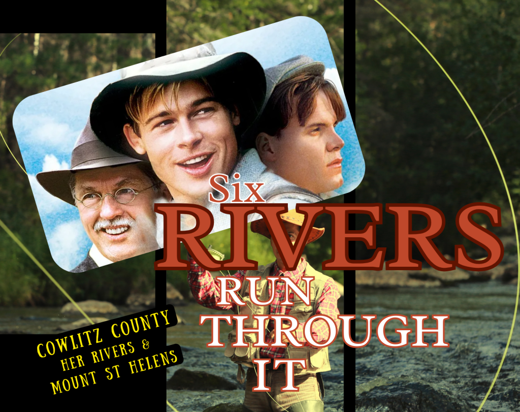
Six Rivers Run Through it: by Mark Smith * November 2025
The Rivers of Cowlitz County, past, present, and future: How they got to where they are today.
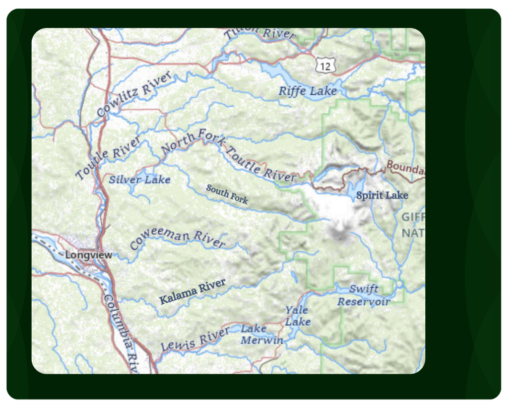
In the beginning, not just one river ran through Cowlitz County, but six: the Columbia, Kalama, Lewis, Coweeman, Toutle, and the Cowlitz. These rivers were vital to the development of Cowlitz County, which became home to the world’s largest timber industrial manufacturing center. With the main stems of the Lewis and Kalama rivers connecting to the Columbia above the mouth of the Cowlitz, they provided ease of transportation for raw wood products to the mills in Longview and Kelso. Then, looking to the Northeast, the Coweeman and Toutle Rivers extended these transportation routes down to the Cowlitz and the mighty Columbia. These rivers provided transportation routes for products and trade goods to local communities and around the world. Making this area a natural place for cities to be born. Before any roads or highways were ever constructed, the County was founded in 1854, and the City of Kelso was founded in 1884, making it the first legally claimed property in the County.
Jobs were created, and anyone who wanted to work could find plenty of opportunities. In addition to employment, these rivers provided a high quality of life through the abundance of our natural resources. With year-round runs of salmon, steelhead, smelt, and resident sturgeon, fish were a mainstay in everyone’s diet; they were abundant.
With Cowlitz County’s growth came the demands for more energy; the first of our six rivers to fall to the hydroelectric industry in the Northwest was the Lewis. The history of the Lewis River dams is marked by the construction of four hydroelectric facilities—Merwin, Yale, and the two Swift dams —built between 1931 and 1958. Built by the Cowlitz County Public Utility District and Pacifi-Corp, these dams on the North Fork Lewis River created large reservoirs that generated a significant amount of electricity but blocked salmon and steelhead from reaching their historic spawning grounds. In response, Pacifi-Corp now operates a “trap-and-haul” system, transporting fish around the dams to enable access to upstream habitat. Despite these efforts over the past 60 years, fish populations on the Lewis River have been steadily declining.
The next river to fall victim was the Cowlitz. The main dams are Mayfield and Mossyrock, built by Tacoma Power. The construction of the dams on the Cowlitz River faced strong opposition due to their significant environmental and cultural impacts. The development occurred between the 1950s and 1990s, and it dramatically reshaped the river system, particularly affecting native fish populations. We have also witnessed sediment buildup in the lower river due to restricted flow.
In 1978, Cowlitz County was home to a $22 million fishery, supported by year-round runs of salmon, steelhead, smelt, and resident sturgeon. Fishing shacks lined the mighty Cowlitz from the mouth of the Toutle to the Columbia. Fishing was a significant part of life. We had commercial fishermen, fishing gear manufacturers, everything from poles to lures to boats. Cowlitz County boasted the largest fish runs and the biggest fish, and fishermen from around the world came to try their hand at catching them in our rivers.
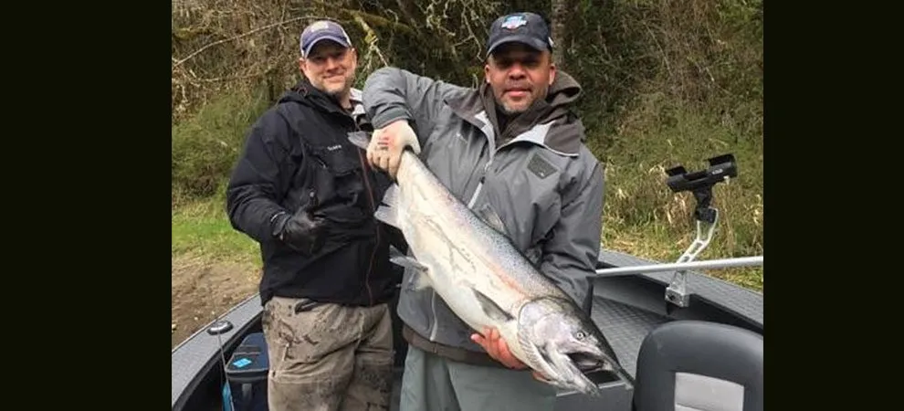
Guide services were abundant, from the banks of the river to the ultimate jet sleds equipped with fish finders that transported people up and down the rivers to where the fish were. For a few decades, Cowlitz County was unmatched for its river recreation and fishing, and life was good.
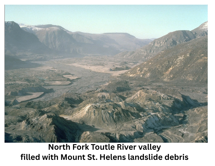
Then on May 18, 1980, at 8:32 AM, Mount Saint Helens erupted, sending a massive wall of debris and mud down the North and South forks of the Toutle, through the Cowlitz, and out to the Columbia, where it filled in the 43-foot shipping channel, stranding ships and grinding commerce to an abrupt halt. The sediment in Castle Rock was approximately 81°, causing fish to jump right out onto the bank to escape the heat. This catastrophic event wiped away all aquatic life as we had known it and changed the Toutle and Cowlitz Rivers forever. Over 265 homes were damaged or destroyed, an estimated 27 bridges, 185 miles of roadway, 15 miles of railroad line, and 57 people lost their lives. When the day settled, our once-beautiful rivers were devastated, buried under millions of yards of mud, rock, and debris.
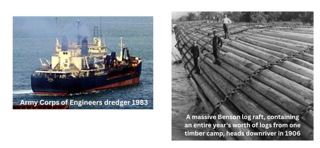
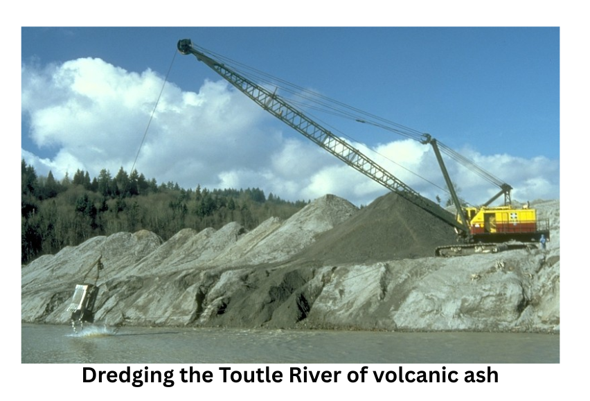
The US Army Corps of Engineers immediately began dredging and cleared the Columbia, Cowlitz, and Toutle Rivers in 100 days. Cowlitz County Commissioners placed a 20-year building moratorium on areas affected by the event and at risk of flooding again. In 2000, the building moratorium expired, and the county began issuing building permits on top of dredge spoils and in locations identified as needed for future dredging. Allowing the moratorium to fully expire is hindering the dredging we need to do today. We need areas to store the spoils, but most of it is now private property owned by individuals.
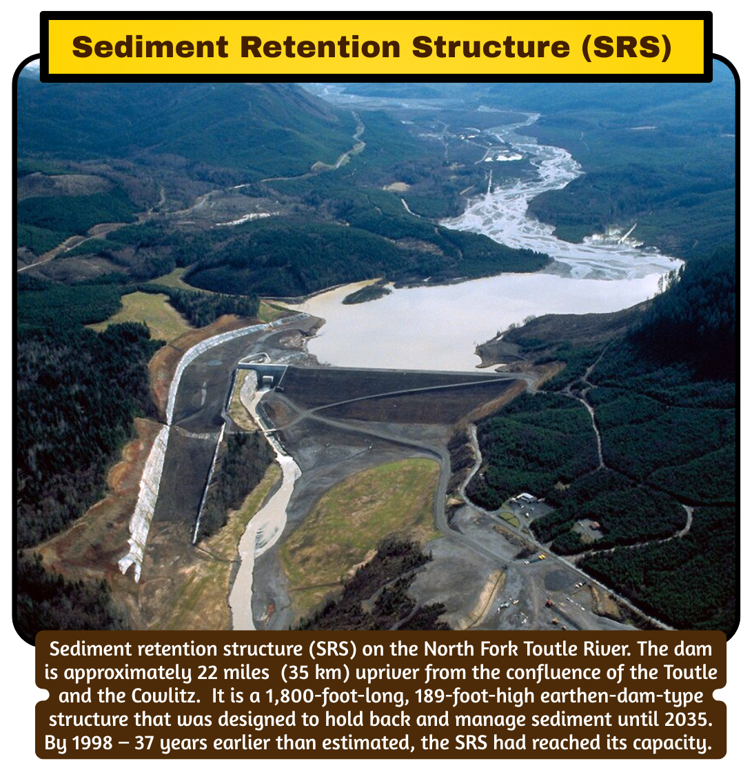
Due to negative views of dredging at the time of the eruption, the Army Corps of Engineers developed a plan to store sediment higher up in the North Fork Toutle River Valley. They completed construction of the Sediment Retention Structure (SRS) in 1989. The SRS is a 1,800-foot-long, 189-foot-high earthen-dam-type structure that was designed to hold back and manage sediment until 2035. By then, they were to develop a long-term solution to manage the flood risk and sediment from Mount Saint Helens. The SRS was originally constructed with a spillway that was fish passable when sediment reached the crest, allowing water to flow around the structure. By 1998 – 37 years earlier than estimated, the SRS had reached its capacity.
The US Army Corps redesigned the system to operate with a series of spillway raises that would increase efficiency and the amount of sediment the structure could hold back. The SRS spillway was initially built with fish passage, but the section that provided it was damaged during the 1996 flood event and never repaired.
Fish passage was mitigated with the Washington Department of Fish and Wildlife (WDFW) to support and operate a Fish Collection Facility (FCF) that would implement a trap-and-haul fish transport process. The US Army Corps of Engineers designed and built the Fish Collection Facility (FCF) and operated it for two years before turning it over to WDFW. The trap-and-truck management program was designated only for transporting two species: coho and steelhead.
Unfortunately, the structure’s design failed due to the heavy sediment load. It has proven inefficient to meet the needs and demands for transporting fish around the SRS at any sustainable level. The current amount of fish returning has averaged from a high of 400 to as few as 100 per year. After 45 years, I feel that any fish fighting to return to the river should be given every opportunity to do so. I would like to see natural fish passage reintroduced in the North Fork Toutle River, allowing nature to decide which aquatic species should return to the upper sections of the river.
In about 2010, the US Army Corps of Engineers engaged in an experiment on the sediment plain above the SRS. With shovel-ready funding from the Obama Administration, they installed large woody debris, island structures, and an extensive series of weirs, forming a cross-valley structure. They were constructed to determine how much sediment they could hold/stabilize, as well as to assess whether they could be a more cost-effective alternative to the spillway raise with less adverse impact on the surrounding area’s natural recovery. The Corps studied these structures for 2 years and, unimpressed by the results, in 2012, they installed the first 7 ft spillway raise. This flooded the sediment plain, raising its level fast enough to wipe out the minimal native vegetation and back up into tributary streams, setting back the natural recovery for over two miles behind the SRS for over a decade. They expected to get 10-15 years of sediment storage to benefit the lower Cowlitz River, but it lasted only 3-5 years, less than half of their original estimate.
Over the last 15 years, the University of Nottingham in England has been measuring and studying island and cross-valley structures. Their work shows that the structures have managed to store and stabilize sediment long enough to support forest regeneration, thereby enhancing natural recovery. At the same time, the volume of sediment coming off the mountain’s sediment plain has slowed down further, enabling these structures to be more effective.
Today, communities along the lower Cowlitz River are concerned that sediment is filling the river, raising concerns about flooding and dikes. The US Army Corps of Engineers has proposed raising the spillway by 10 ft, at an estimated cost of $56 million. Of course, this rise will once again flood the plain and kill the natural recovery that has taken hold since the last rise. It will have an immediate negative effect on tributary streams, making fish passage near impossible. Permits were awarded for this project in 2019, but were delayed by COVID. River conditions have changed over the last six years, and according to the Corps’ own data, a rise does not appear necessary at this time, and it would not have any immediate effect or relief on the lower Cowlitz River. Only intelligent dredging will bring immediate relief to the lower Cowlitz. The Corp has three main options in their sediment management toolbox. The spillway rise at the SRS, intelligent sight-specific dredging in the lower rivers where and when needed, and the nature-based engineering with large wood structures above the SRS. Since the completion of the SRS, they have implemented two of the three options: the nature-based large wood structures in 2010, and the 7ft spillway rise in 2012. We have learned what to expect from these two options, with one proving to be far more beneficial in the long run.
Given current river conditions and lower river needs, I would like to propose that the Corps reallocate the $56 million to intelligent dredging in the lower river. I believe this would provide immediate relief and protection to our communities where they need it. At the same time, we should advocate for more nature-based engineering in the North Fork Toutle River Valley to further support sediment collection and stabilization, in hopes of restoring a green valley bottom once again. We should also create a sediment dredge management plan for the lower river, to be reviewed annually. This could buy us more time and save the 10 ft spillway rise in case we need it in the future.
I urge you to get involved; it is your river and land, share your thoughts on how we should live with its risks and benefits. For more information, Google Mt St Helens N Fork Toutle River Sediment Management Plan, or visit the Spirit Lake Toutle Cowlitz River Collaborative website.
Additional Website and Article information:
https://pubs.usgs.gov/sir/2007/5185/section7.html ( fish temp\info)
Sediment retention after the 1980 eruption of Mount St. Helens
https://www.youtube.com/watch?v=IWZgiSseDWs
Professor discusses the impact of Mount St. Helens’ eruption
https://www.youtube.com/watch?v=GONwMl7IalA…
USDA & US Forest Service: Mount St Helens Eruption; Spirit Lake and Toutle River …